
Using Big Remote Sensing Data in Building a geographic information system to support and develop the cultural heritage sites in Egypt (New Valley Governorate: Case Study)
Researcher:
Prof.R.Eng./ Ghada Atta Youssef
Summary of project:
Big Remote sensing data have played an important role in the field of managing and supporting cultural heritage sites as a result of the valuable information that can be obtained from that data, which would identify the changes in the land use/cover of lands close to heritage sites over a wide range in real-time and over the long term. Cultural heritage sites include natural and human heritage sites (tangible and intangible), which are irreplaceable and also invaluable. The preservation of heritage sites, whether tangible or intangible, is an important and pivotal factor in sustainable development issues, which can provide many investment opportunities, which is considered support for tourism activities and therefore the national economy, which is in line with the philosophy of the United Nations Educational, Scientific and Cultural Organization (UNESCO). Egypt is one of the most important countries rich in cultural heritage sites, as it includes among its flanks seven sites listed within UNESCO, some of which date back to millions of years, while others go back to the Stone Ages, pre-dynastic, Pharaonic, Greek, Roman, Coptic, until Islamic era. Undoubtedly, many cultural heritage sites in Egypt suffer from the dangers of human activities that may greatly threaten these sites. In addition, there are many sites that have historical importance that did not receive attention, especially in the governorates that the state recently sought to develop such as the New Valley Governorate. Therefore, this project aims to detect, monitor, and protect cultural heritage sites in the New Valley Governorate, in addition to evaluating and identifying the risks that threaten these sites using modern remote sensing techniques and GIS tools. Providing a lot of information that will help improves the quality of management of cultural heritage sites in the New Valley Governorate in line with the United Nations Sustainable Development Goals and Egypt's Vision 2030, is one of the main expected results of this project.
The objective of the project:
Creating archaeological maps of cultural heritage sites in the New Valley governorate.
Building an information system for the geospatial documentation of the archaeological sites in the New Valley governorate.
Develop a proposal to develop and improve the environmental condition of the heritage sites in the New Valley governorate.
The most important outputs:
Monitoring the surrounding risks of the cultural heritage sites in the governorate based on detecting the changes in the use of land in the long term and its impact on the heritage sites in the governorate.
Creation of some tourist maps that will facilitate archaeological visits to heritage sites as an important source of national income and thus improve the economic situation of the local population.
Highlighting the importance of the archaeological sites in the governorate by making archaeological maps that include a profile of each archaeological site and its historical and archaeological importance.
Creating some innovative models based on large satellite data to reduce the risks to which heritage sites are exposed and to adapt to climate change.
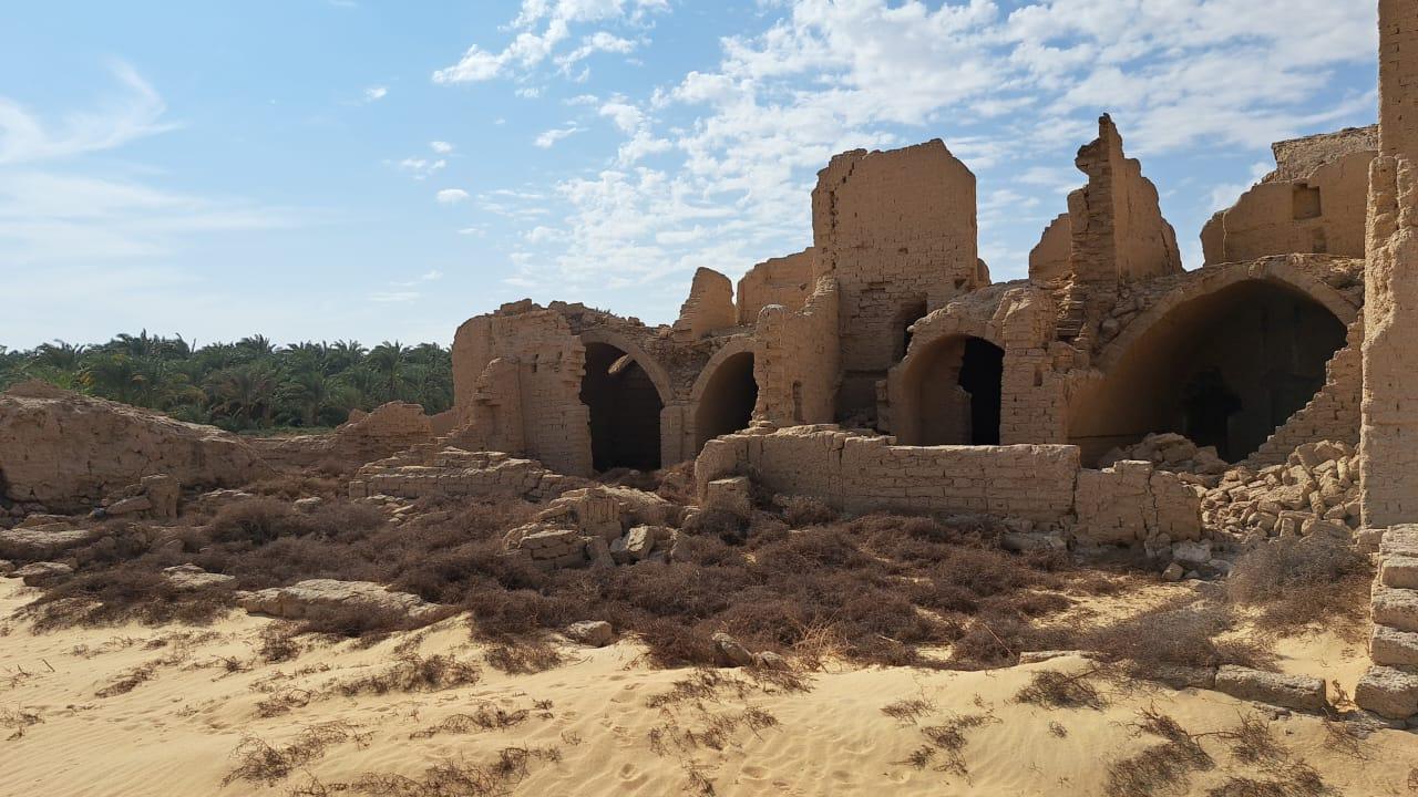
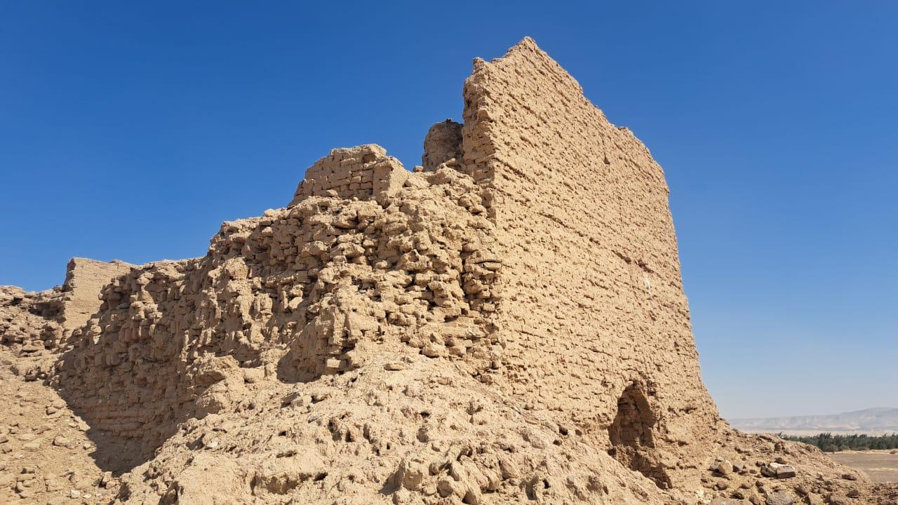
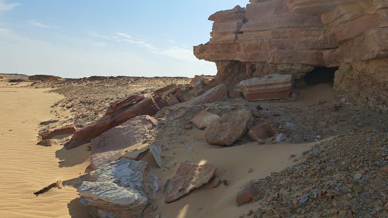
A collection of images that express the outputs
Latest Events
Latest News

NARSS
National Authority for Remote Sensing & Space Sciences
NARSS is the pioneering Egyptian institution in the field of satellite remote sensing. NARSS is an outgrowth of a Remote Sensing Center, established in 1971 as an American-Egyptian joint project that was affiliated to the Egyptian Academy of Scientific Research and Technology


