Under the auspices of the Minister of Higher Education and Scientific Research The National Remote Sensing and Space Science Authority participates in the Cairo ICT23 exhibition
-Review of the role of the Remote Sensing Authority in the implementation of several national projects to serve State development plans.
- Emphasizing the important role of remote sensing applications in development.
- Use of remote sensing technique to monitor, account for and classify strategic crops.
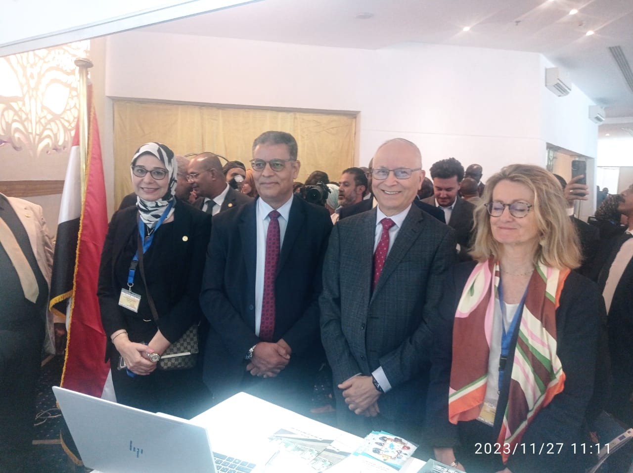
Under the auspices of Dr. Ayman Ashour, Minister of Higher Education and Scientific Research, the National Authority for Remote Sensing and Space Science participated in the Cairo International Technology Fair, Cairo ICT23, which was held from 19 to 22 November 2023, under the auspices of the President of the Republic, Mr. Abdelfattah Al-Sisi, and witnessed the presence and honour of Dr. Mustafa Madboli, Prime Minister.
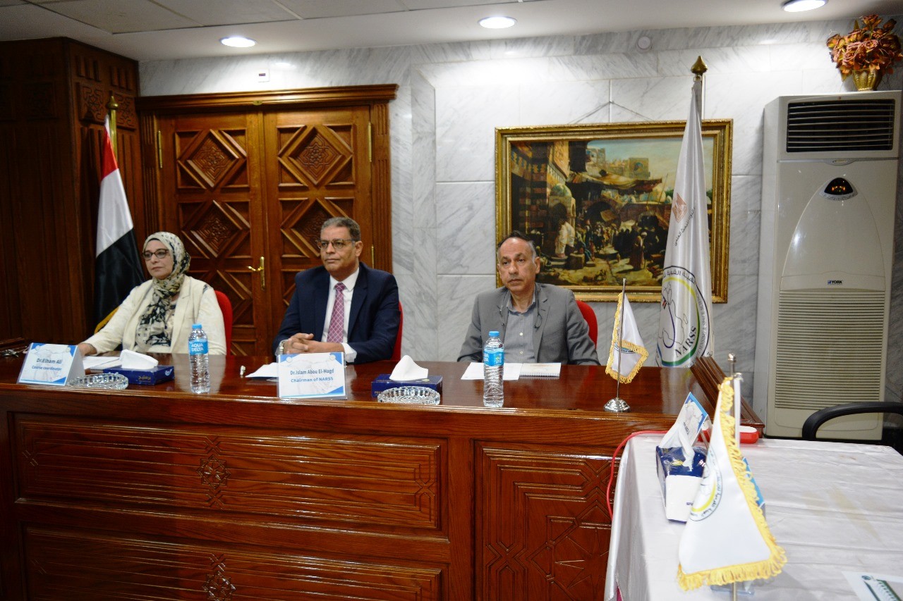
The Authority participated in a scientific consultative session entitled "The Future of Satellite Communications - Small Satellite, Big Impact," which included the symposium Dr. Islam Abu Al-Magd, Chairman of the National Remote Sensing and Space Science Authority, D. Sheriff Sadiqi, Executive Chairman of the Egyptian Space Agency, Dr. Sami Shedid, CEO of the National Telecommunications Company and Mr. Gary Perry, Director of Strategic Sales of Inmarsat Communications.
In his statement, Dr. Islam Abu Al-Magd explained that the National Remote Sensing and Space Science Authority was one of the oldest bodies, over 50 years old, which had embraced the national space programme and the first space strategy in Egypt in 1998, through which the first remote sensing satellite had been launched in 2007, and had helped launch two Cubesat satellites during 2017 and 2019, pointing out that the Authority was responsible for the use of satellite data in development processes in various sectors and for effective participation in the social and economic advancement of the State.
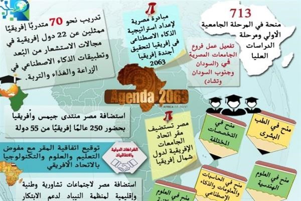
In cooperation with the Ministry of Higher Education and Scientific Research, the Authority had prepared the Egyptian file for hosting the headquarters of the African Space Agency. The Agency had succeeded in hosting five competing African States in that regard. It had also participated in the preparation of space policies and strategies in Africa. In addition, it had the operational, strategic and institutional expertise that placed it among the countries advanced in that area, regionally and internationally. It had participated in and implemented several national projects that served the State's development plan and the realization of The State's development plan and achieving Egypt's vision 2030. It had partners in the region and outside the region and had many projects in Africa and in the North African countries.
The Authority has contributed to the development efforts led by the political leadership in Egypt through space data, numerical models and statistical analyses to provide accurate and up-to-date information that will help decision makers and implementers to make a sound executive decision. The Authority is directly involved in the provision of these national projects and services and presidential initiatives, including when the presidential initiative was launched to increase the agricultural landscape to 1.5 million acres. Through satellite data, the Authority identifies, both radar and hiberspectal, with field visits, approximately 4 million arable acres.
Remote sensing was currently being used to help the Ministry of Agriculture monitor, account for and classify national strategic crops such as wheat, maize, high corn, cotton and sunflowers. There were also applications for remote sensing of mineral wealth to determine where technological industries could be based. One of the most important of those places was the East Sahara, such as the Golden Triangle. Mineral investment zones were being proposed according to available information on rocks, minerals, building materials and decorations. The Authority would hold a specialized symposium on that matter. All interested persons and investors in mineral wealth would be invited.
While it was common among people that one of the most important uses and applications of space was communications, applications for the use of space for photography and the installation of cameras with different technical specifications on the Moon revolved around the Earth and gave us continuous data that was much equivalent to communications service, since those satellites filmed everything on the surface of the Earth, and scientists and experts therefore analysed that image and extracted information that would become useful services for society, emphasizing that the Authority would work with the private sector to achieve sustainability and social returns at the national, regional and international levels.
Latest Events
Latest News
NARSS
National Authority for Remote Sensing & Space Sciences
NARSS is the pioneering Egyptian institution in the field of satellite remote sensing. NARSS is an outgrowth of a Remote Sensing Center, established in 1971 as an American-Egyptian joint project that was affiliated to the Egyptian Academy of Scientific Research and Technology


