Cooperations
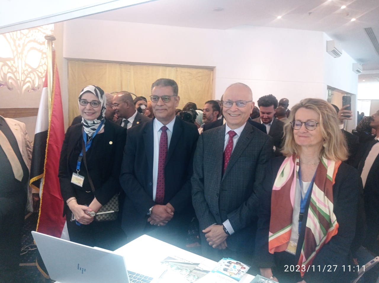
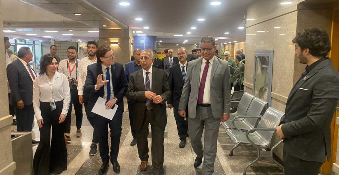
Regional & International Cooperation and Initiatives
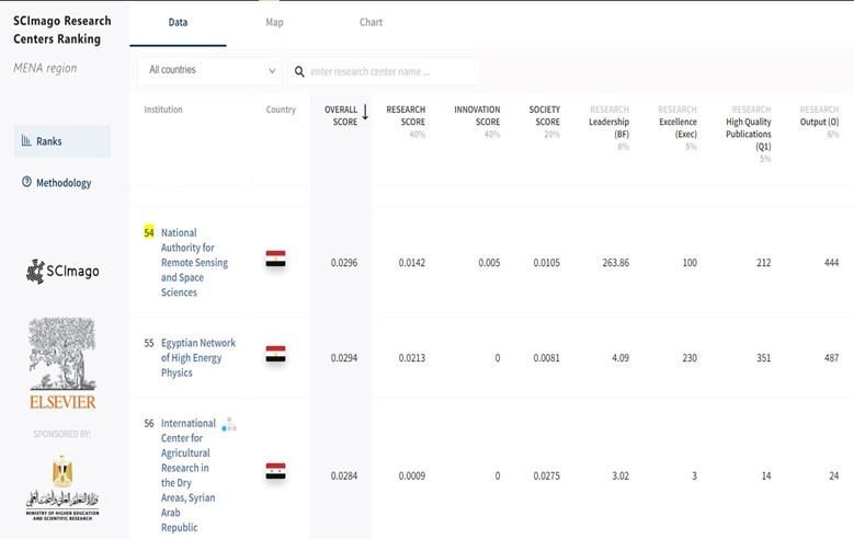
NARSS has an excellent network with international organizations and Regional institutions. International organizations such as European Framework Program (FP6 & FP7), American Egyptian Fund (National Science Foundation – NSF), Canadian Space Agency – (CSA), European Space Agency (ESA), Japanese Universities (Waseda and Tokai), European Union. NARSS has signed more than 53 memorandums of understanding (MOU) with regional and international institutions for the cooperation in space technology and remote sensing applications. This helps to foster research, development and knowledge transfer with these organizations.
Projects funded by the European Framework programs, The World Bank & African Union Commission and European Union:
Event : African Leadership Conferences (ALC)
Event : 4th International ASD Users Meeting" in Middle East"
Cooperation with Japanese Universities (Waseda and Tokai)
Event : The 4th Egyptian Japanese Joint Symposiums Schedule
Cooperation with China
A memorandum of understanding has been established between NARSS and the institute Of Remote Sensing Applications (IRSA), Chinese academy of sciences (CAS). The purpose of this MoU is to establish a framework for cooperation in the field of remote sensing applications among the participants on the basis of equality, benefits to all Participants, and reciprocity. Cooperation under this MOU may include the different areas of interest which make one or more of the following forms:
1. Cooperation in remote sensing applications between governmental departments and agencies, and academia
2. Joint research, technology projects and activities;
3. Exchange of scientists, engineers and other experts;
4. Liaison with industrial, academic, professional and other organizations;
5. Exchange of scientific information, data and experimental results;
6. Organization of symposia, seminars, conferences, meetings and special events;
7. Education and training; and
8. Other cooperation activities that may be decided by mutual consent of the participants
Cooperation with Italy
The purpose of this Memorandum of Understanding is to establish a legal framework for the cooperation between NARSS and the Italian Space Agency in the field of Remote Sensing of the Earth and to explore the conditions for implementing projects of mutual interest.
Areas of cooperation
· Earth observation science and research
· Earth observation research and applications
· Data reception and data exchange
· Education and training projects
· Promotion of joint studies, workshops and symposia
· Promotion of industrial collaboration and data commercialisation
Cooperation in PEGASO Project
The main objective of PEGASO; People for Ecosystem Based Governance in Assessing Sustainable Development of Ocean and Coast is to build on existing capacities and develop common novel approaches to support integrated policies for the coastal, marine and maritime realms of the Mediterranean and Black Sea Basins in ways that are consistent with and relevant to the implementation of the ICZM Protocol for the Mediterranean.
PEGASO will use the model of the existing ICZM Protocol for the Mediterranean and adjust it to the needs of the Black Sea through three innovative actions:
1.Constructing an ICZM governance platform as a bridge between scientists and end‐user communities, going far beyond a conventional bridging.
2.Refine and further develop efficient and easy to use tools for making sustainability assessments in the coastal zone (indicators, accounting methods, models and scenarios).
3.Implementation of a Spatial Data Infrastructure (SDI)
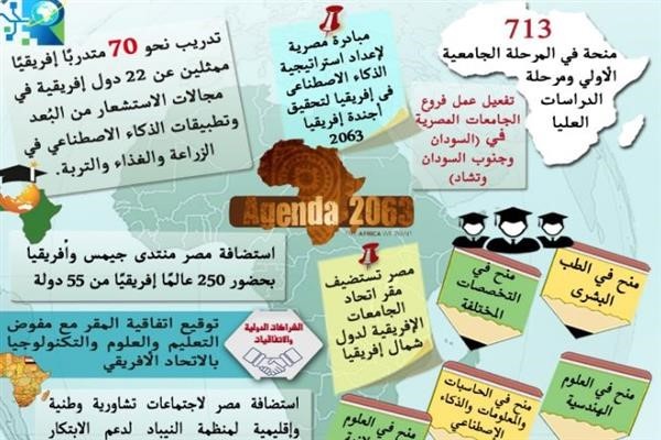
Cooperation with GMES and Africa,
The GMES & Africa (Global Monitoring for Environment and Security for Africa) is a response to the Africa-EU 8th Partnership on "Science, Information Society and Space". This initiative started after the Maputo Declaration in April 2006 and during the EU Portuguese Presidency with Lisbon Declaration in December 2007. The initiative is mainly aimed at making Earth observation an operational tool for African decision makers for sustainable development and poverty alleviation.
GMES and Africa focuses on Earth observation applications with key objectives, which are:
-help decision makers in understanding the importance of Earth observation for sustainable development and poverty alleviation,
-improve the Earth observation capacity building and infrastructures in Africa,
-define governance, coordination and data policies within African nations,
-increase African institutions in earth observation technology and experience for improved environment and natural resources monitoring as well as transboundary resources conflicts,
-identify thematic priorities to enhance the life quality in Africa such as health, water management, coastal and marine development and food security
-Outline operational modalities by allowing Africa to make full potential use of space systems for sustainable development and reinforcing Africa's capacity and ownership in using and contributing to remote sensing science.
---------------------------------------------------------------------------------------------------------
 Ain Shams University
Professional Diploma in Remote Sensing and Geographic Information Systems
Project: National Space Alliance
---------------------------------------------------------------------------------------------------------
 National Institute of Astronomical and Geophysical Research
Project: National Space Alliance
---------------------------------------------------------------------------------------------------------
 Metal Research Center
Project: National Space Alliance
---------------------------------------------------------------------------------------------------------
 Cairo University
Project: National Space Alliance
---------------------------------------------------------------------------------------------------------
![]() Maritime Academy for Science Technology and Maritime Transport
Maritime Academy for Science Technology and Maritime Transport
Project: National Space Alliance
---------------------------------------------------------------------------------------------------------
 Optics Factory
Project: National Space Alliance
---------------------------------------------------------------------------------------------------------
Project: National Space Alliance
---------------------------------------------------------------------------------------------------------
 Benha Electronics Factory
Project: National Space Alliance
---------------------------------------------------------------------------------------------------------
 The Egyptian Company for Space Applications and Remote Sensing.
Project: National Space Alliance
---------------------------------------------------------------------------------------------------------
Cooperation with provinces
 ElBeheira Governorate
Project: Monitoring and mapping of land uses Wadi Natroun of Beheira Governorate.
Project: Remote Sensing applications in fish development in Lake Idku, Beheira Governorate
---------------------------------------------------------------------------------------------------------
 Port Said Governorate
Project: Building geo-database for supporting the developmental plans in Port Said Governorate
---------------------------------------------------------------------------------------------------------
 New Valley Governorate
Project: Establishment of a Digital Geographic Database for the New Valley Governorate
---------------------------------------------------------------------------------------------------------
 Qalyoubia Governorate
---------------------------------------------------------------------------------------------------------
 Alexandria Governorate
---------------------------------------------------------------------------------------------------------
 ElFayoum Governorate
Project: Building geo-database for supporting the developmental plans in El-Fayoum Governorate
--------------------------------------------------------------------------------------------------------
NARSS carried out a number of joint projects with regional institutes as follows:
 National Telecom Regulatory Authority
---------------------------------------------------------------------------------------------------------
 Elap Petroleum Company
---------------------------------------------------------------------------------------------------------
 TRAVCO Engineering & Construction Co.
---------------------------------------------------------------------------------------------------------
 General Authority for Fish Resources and Development
---------------------------------------------------------------------------------------------------------
 General Authority for Tourism and Development - Matrouh Governorate
---------------------------------------------------------------------------------------------------------
 Alexandria Petroleum Company
---------------------------------------------------------------------------------------------------------
 New Urban Communities Authority
Project: Land Reclamation, Reconstruction & Development of El Fashn New City in Beni Suef
---------------------------------------------------------------------------------------------------------
 Hassan Allam Sons Company
---------------------------------------------------------------------------------------------------------
 General Authority for Construction and Housing Cooperatives
---------------------------------------------------------------------------------------------------------
 Egyptian Wastewater Regulation Agency and Consumer Protection
---------------------------------------------------------------------------------------------------------
 National Authority for Potable Water and Sanitation
---------------------------------------------------------------------------------------------------------
Latest Events
Latest News
NARSS
National Authority for Remote Sensing & Space Sciences
NARSS is the pioneering Egyptian institution in the field of satellite remote sensing. NARSS is an outgrowth of a Remote Sensing Center, established in 1971 as an American-Egyptian joint project that was affiliated to the Egyptian Academy of Scientific Research and Technology


