Sustainable Development plan for Toshka - Maohamed Nagib Base Corridor
Researcher:
Prof. Dr. Mohamed Naguib Hegazy
Summary of project:
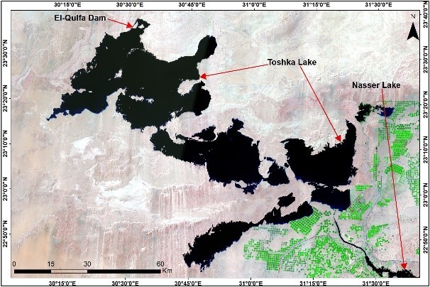
It aims to get rid of the surface water in the Toshka Lakes as an uncontrolled body of water by delivering the lakes’ water to the Muhammad Najib base and to the nearest port to achieve sustainable development, provided that the path of that line is from south to north so that the water flows naturally in accordance with the general direction of the slope. The earth's surface.
The route follows the Darb al-Arbaeen road, passing through the cities of the New Valley Governorate (Paris, Kharga, Dakhla, and Farafra), which saves quantities of groundwater that are currently used for domestic use and agriculture.
A number of satellite images taken on successive dates will be used to follow the development in the amount of water stored in the lakes. A three-dimensional model will also be used to create depth maps of the lakes and determine the amounts of silt collected in the lakes and its spatial distribution. Also, a mechanical and chemical analysis of the silt was carried out in order to identify the quality and quantities of minerals, etc., and the possibility of using it as mineral wealth or to improve the properties of agricultural soil by transferring it to reclaimed lands.
Through the implementation of the project, the best route will be proposed to establish a railway line starting from Toshka to run parallel to the route of the water carrier passing through the aforementioned New Valley cities. The presence of this line will facilitate the transfer of quantities of silt from the lakes to the reclaimed lands, as well as the transfer of fish and crocodiles found in the lakes to The cities on its route and then to the ports of the Mediterranean. The railway line is also being used to transport agricultural crops produced from agricultural projects for export abroad via Mediterranean ports instead of using airplanes.
The objective of the project:
1. Providing large quantities of groundwater that were used for agriculture and domestic use in cities and reclaimed areas in the New Valley Governorate.
2. Improving the quality of lands in agricultural development areas in Western Sahara, including the new delta areas
3. Optimal exploitation of fish wealth and marine life in the lakes
4. Saving the expenses of using air transport to transport and export agricultural crops and transport them to ports
Navy to use the proposed railway line.
The most important outputs:
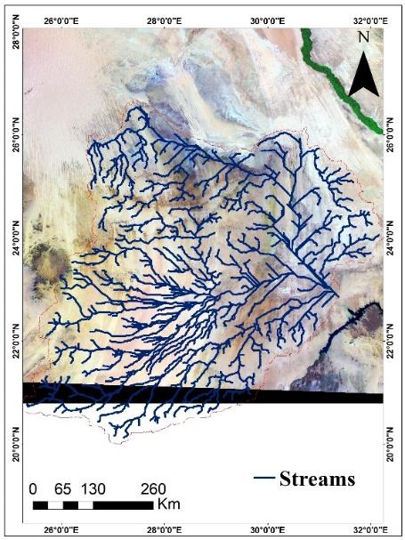
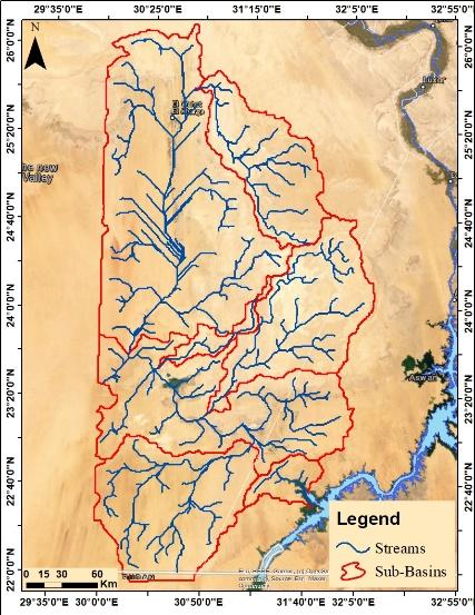
Subbasins were created for the study area.
Water streams have been created.
The Soil map has been made.
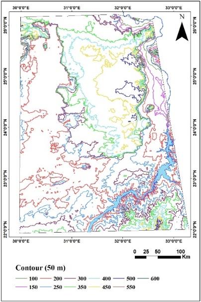
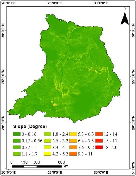
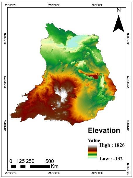
DEM slope/contour/maps were made.
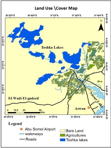
Landcover/use map created.
A collection of images that express the outputs

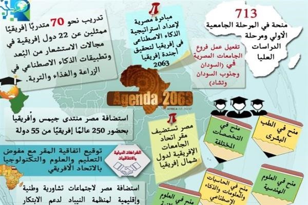
Latest Events
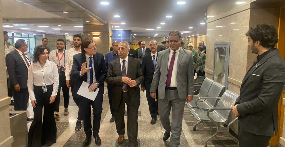
Latest News
NARSS
National Authority for Remote Sensing & Space Sciences
NARSS is the pioneering Egyptian institution in the field of satellite remote sensing. NARSS is an outgrowth of a Remote Sensing Center, established in 1971 as an American-Egyptian joint project that was affiliated to the Egyptian Academy of Scientific Research and Technology


