Integrated land models for agriculture sustainability management: a case study West of El-Minya Governorate as a new development area
Researcher:
Prof.R.Eng/ Muhammad Al-Adham Mahdi Fadl
Summary of project:
Agricultural sustainability development is essential in the modest Egyptian national income to improve land production and conservation of natural resources, which must cope with population growth with addition of new land reclamation that has lot of sustainability obstacles confrontation agricultural development such as; soil characteristics, alkalinity and salinity limitation, socio-economic factors, soil type and other environmental hazards. Sustainability framework is includes five factors; productivity, security, protection, economic viability and social acceptability.
Sustainable agriculture refers to long term goal aiming at assessing environmental problems and constraints that confront the economic viability, environmental validity and social acceptability of land production. To evaluate agriculture sustainability levels for agricultural development there are five factors; soil productivity, security, protection, social acceptability and economic feasibility. Agricultural sustainability concept is used to provide land resources and food to include food availability for population needs and maintain natural resources and ecosystem services.
Agricultural sustainable management receives considerable support and acceptance within agriculture prevailing, depending on some environmental and social concerns. Some sustainable factors are used as sustainability indicators, which not only quantifies production but also allows identifying the experimental sustainability and farmer practices gaps.
The sustainability concept has been made operational in agricultural situations and imperative to a comprehensive assessment effect that integrates economic, ecological and social sustainable factors to identify land sustainability.
Agricultural sustainability can be improved through national management, including land resource management domains. Sustainability factors (productivity, protection, security, economic viability and social acceptability) are used in Egypt to evaluate sustainability statuses that prevent land development to acceptable levels for high production attempts. GIS modeling techniques will used to identify sustainable development and land use assessment beside on environmental effects and socio-economic conditions evaluations, agricultural sustainable spatial model will developed to classify the land sustainability, according to sustain ability rates. GIS model will executed for land evaluation, meanwhile the biophysical, fertility and the environment data is need to evaluate soil properties to achieve land suitable planning and it is considered useful tool to process spatial data of land resources in different scales and formats providing accessible land evaluation. The main objective of the current study is to determine and evaluate current status of agriculture sustainability utilization for agriculture development and optimum land use managements planning in West of El-Minya Governorate as a new development area using sustainable agricultural framework and Designed Sustainable Potentiality Spatial Model (DSPSM), through sustainability factors combination using GIS spatial analyst techniques.
The objective of the project:
Using GIS spatial analyst techniques to evaluate current status of agriculture sustainability utilization for agriculture development and optimum land use managements planning in West of El-Minya Governorate as a new development area using sustainable agricultural framework.
Designed Sustainable Potentiality Spatial Model (DSPSM) through sustainability factors combination.
Evolution of environmental hazards for development and sustainable planning.
Production of base maps.
Production of agriculture sustainability assessment maps.
Suggesting that accelerate sustainable development reducing the depletion of natural resources of the study area.
Providing decision support at different levels for better land sustainable management.
The most important outputs:
1- Using remote sensing techniques to determine and evaluate the current status of the sustainable use of agriculture for agricultural development.
2- Processing spatial data of land resources at different scales and formats provides accessible land assessment.
3- Planning for optimal land use management in the West El-Minya region using a sustainable agricultural framework.
4- Design a spatial model for sustainable agricultural capacity (DSPSM), through agricultural sustainability factors using GIS spatial analysis techniques.
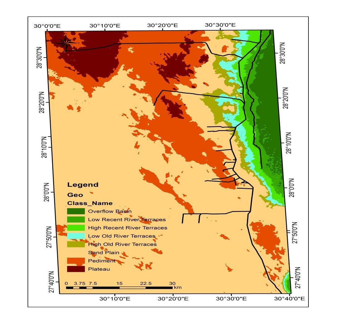
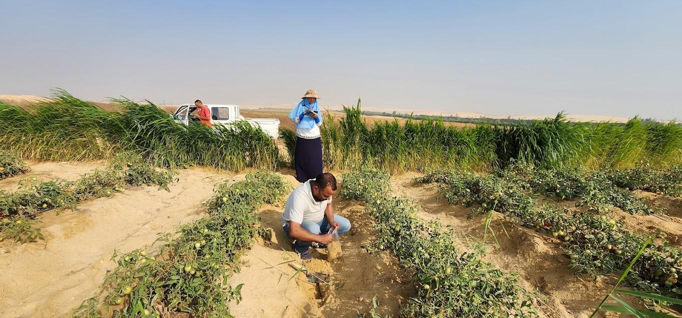
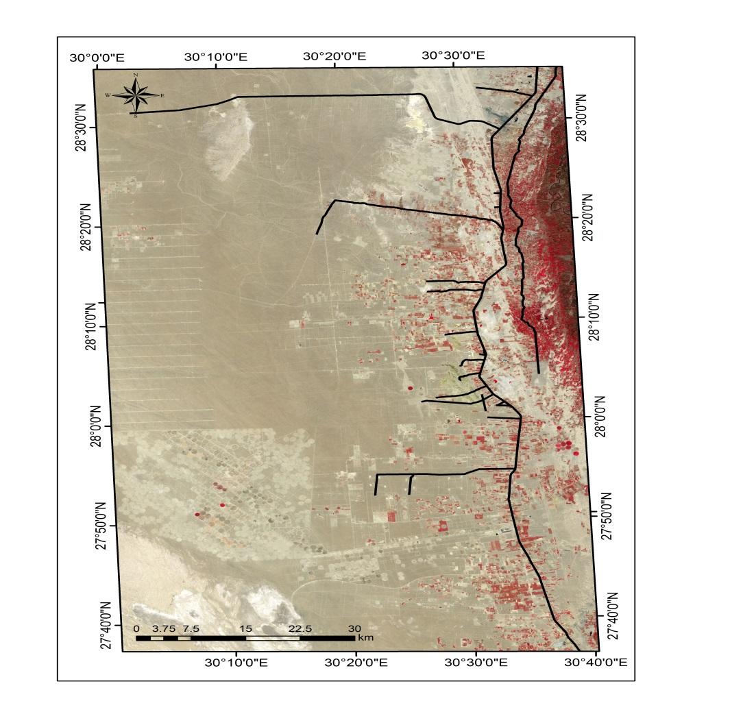
A collection of images that express the outputs

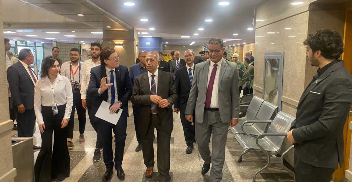
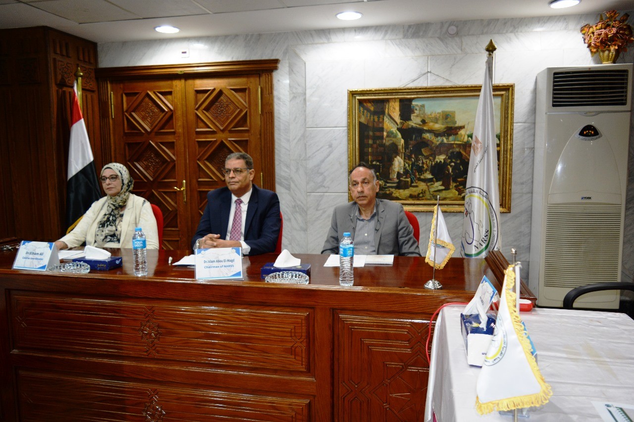
Latest Events

Latest News

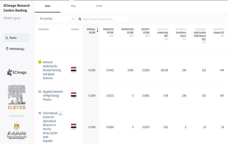
NARSS
National Authority for Remote Sensing & Space Sciences
NARSS is the pioneering Egyptian institution in the field of satellite remote sensing. NARSS is an outgrowth of a Remote Sensing Center, established in 1971 as an American-Egyptian joint project that was affiliated to the Egyptian Academy of Scientific Research and Technology


