The impact of environmental and climatic factors on the return and spread of disease-carrying mosquitoes in Beheira Governorate using geospatial techniques
Summary of project:
The proposed project relies on an integrated approach that includes field surveying, laboratory analyses, cartographic modeling, and remote sensing data processing to assess environmental factors and climate changes and their relationship to disease-carrying mosquitoes in order to characterize and evaluate environmental risks in Beheira Governorate. The goal of the proposed project is in line with Egypt’s Vision 2030 (improving the level of the Egyptian citizen and developing the governorates).
The objective of the project:
The project aims to characterize and evaluate environmental risks and the risks of mosquito proliferation in Beheira Governorate using spatial analyses, cartographic models, and remote sensing data processing.
The most important outputs:
Identifying the factors causing and influencing the study area.
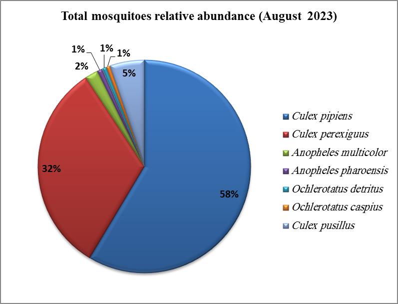
Identify environmental factors associated with mosquito reproduction.
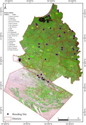
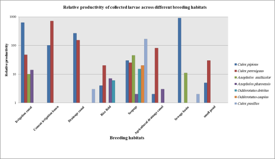
Producing maps of mosquito breeding habitats and identifying the most common types of larvae.
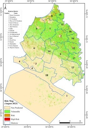
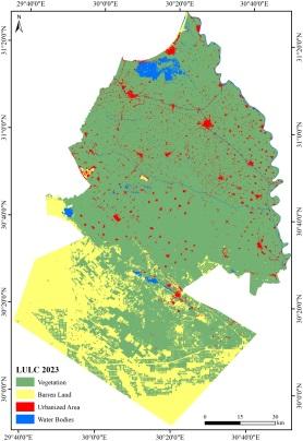
Producing maps of environmental factors and pollution levels & innovative models of environmental risks.
Prepare a detailed report that includes a description of environmental risks and places where mosquitoes spread diseases.
Proposed visions/recommendations & scientific research and technical reports.
Create a database that contains all the information layers that have been produced to maximize benefit and ease of updating and use by decision makers.
A collection of images that express the outputs

Latest Events


Latest News
NARSS
National Authority for Remote Sensing & Space Sciences
NARSS is the pioneering Egyptian institution in the field of satellite remote sensing. NARSS is an outgrowth of a Remote Sensing Center, established in 1971 as an American-Egyptian joint project that was affiliated to the Egyptian Academy of Scientific Research and Technology


