Hydrogeological and Hydrological Studies to Assess the Impacts of Expected Climate Change Scenarios on Water Resources for the Area Extending from Ras El-Hikma to Salloum Using Remote Sensing, Geographic Information Systems and Mathematical Models
Researcher:
Prof. Dr. Hossam Hamdy Aliwa
Summary of project:
The regions of Ras El Hikma - Al Salloum on the northwestern coast of the Mediterranean Sea are considered a large economic area.
Ras El Hikma, is a village belonging to the city of Marsa Matruh, Matrouh Governorate, Egypt. Ras El Hikma is located on the northern coast, its beaches extend from El-Dabaa area at kilometer 170 on the Northwest Coast Road to kilometer 220 in Matrouh, which is 85 km away.
The problem of water in the North Coast is a big problem, which suffers from drought in that region during the summer period, because that region may depend in winter on coastal rainwater. The number of residents in the summer period is much greater than its residents in the winter period. All these things necessitated the search for practical and scientific solutions to this problem.
Drilling wells is the cheapest method, but its main problem seems to be that the water is not suitable for drinking, due to over pumping causes sea water intrusion to groundwater.
The proposed project focuses on the significance of identifying the potential zones in such overexploited areas, and selecting suitable sites for constructing surface water harvesting structures on the watercourses during heavy downpour in the monsoon season to raise the groundwater level to protect aquifer sanctuaries for future sustainability. The activities would utilize the integration of remote sensing (RS), geographic information systems (GIS), watershed modeling systems (WMS) and geophysical techniques as irreplaceable tools to find the baseline data regarding the hydrological potential of a region. The integrative approach also attempts, to detect the best sites for artificial recharge (AR) and to discriminate between aquifers which hold little or no potential for successful AR projects, from those having great potentiality. Ideally, an aquifer will hold, store, and transmit desired amounts of recharge water without significant migration and chemical degradation of that water. Additionally, determining the regarding hydrological properties (e.g. soil type and infiltration rate) of shallow earth materials that can limit the infiltration by surface spreading is a great job to decide which technique of RWH is preferred, storage of rainwater on surface for future use or recharging of ground water, and what are the most adopted artificial recharge methods, Undoubtedly, the benefits of executing the proposed project will have a huge impact on societal life and ecological development, since RWH systems are capable of providing standalone or supplementary water supplies, for domestic or non-potable use throughout the arid zone. Incorporating rainwater, despite of its limitation, as a renewable source into existing coastal zone water supply systems will enhance water security. In addition, rainwater harvesting systems have important implications for storm water management, enhancing community landscapes and land rehabilitation throughout the coastal zone. The project outcomes and recommendations will be a good source for the up-to-date databases, which could be used effectively by the decision makers, researchers, executive authorities, planners, and related governorates. Accordingly, funding is required to perform this sophisticated GIS maps that comprise the essential thematic layers needed to plan for the sustainable development, maximization of groundwater recharge by applying the RWH techniques, water/land use planning, environmental hazards mitigation and coastal management. It is anticipated to provide operational and effective systems of investigation, management and protection of the available natural resources, and improve the livelihood of the surrounding population. The integrative approach of methods RS, GIS, WMS and geophysics is novel in Egyptian RWH and, to date, only a few works concerning this problem have been published.
Climate change is currently considered one of the most important factors affecting water resources (surface and groundwater) as well as the flash flood hazards; as the northern coast of the Western Desert of the Arab Republic of Egypt is located in the arid – semiarid region, which is characterized by the scarcity of water resources, as this region depends mainly on winter coastal rainwater. The number of residents in the summer period is much greater than its residents in the winter period. All these matters made it imperative to search for solutions to these problems.
During the past few years, the government’s interest in the development of the northwestern coast of Egypt, especially for tourism, requires studying the effects of possible climate changes on rainfall and torrential rates, which may have a direct impact on the availability or scarcity of surface and groundwater resources and runoff related hazards. However, this needs an accurate forecasting of rainstorms that are likely to occur as a result of climate change that the world is currently witnessing, Accurate climate change forecasting will be reflected on the efficiency of protection infrastructure against torrential rain, rainwater harvesting facilities and projects for charging groundwater with torrential water, which ultimately contributes to the sustainable development of the region.
The objective of the project:
This project will help in identifying the potential of water resources in Al-Hammam - Al-Fouka areas for sustainable development purposes, as well as in identifying the most suitable places for recharging groundwater aquifers with flood water. In addition, the project will provide a digital and detailed data base on the water resources in the vital and important region, which greatly benefits decision-makers, planners and beneficiaries, which helps achieve sustainable development and thus create new job opportunities.
The most important outputs:
This project will help in identifying the potential of water resources in Ras El-Hikma – Al Salloum areas for sustainable development purposes, as well as in identifying the most suitable places for recharging groundwater aquifers with flood water.
In addition, the project will provide a digital and detailed data base on the water resources in the vital and important region, which greatly benefits decision-makers, planners and beneficiaries, which helps achieve sustainable development and thus create new job opportunities.
An analytical and presentation of climate data over a period of 100 years and the identification of recurring rainstorms and their relationship to historical or recent climatic cycles.
Predicting severe rainstorms with short durations (IDF Curves).
Identifying the design storms by applying the intensity duration curves (IDF), which are used in the design of rainwater harvesting facilities and protection measures in order to raise their lifetime efficiency up to one hundred years.
Determining the most suitable or optimum places for establishing flood protection and rainwater harvesting.
Determining the most appropriate areas for charging groundwater with torrential and rain water and working to link this to the most suitable places for rainwater harvesting facilities.
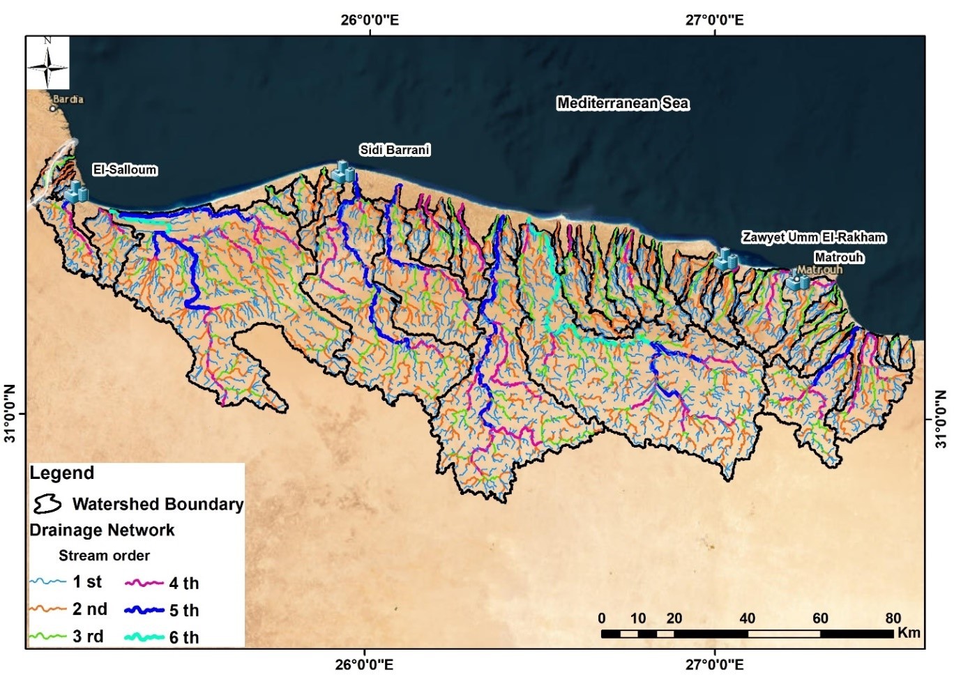
Making hydrological maps of flood paths and their potential quantities based on climatic cycles and prediction studies (e.g.: every 10, 25, 50 or 100 years).
Determining adaptation policies with possible future climatic changes in terms of rain and drought.
Determining the most appropriate policies for water use based on future climate prediction scenarios.
Make maps of the probability of the occurrence of floods and their quantities using corrected geospatial-weighted models, according to the expected climate cycles over the course of 100 years.
Making a master plan for the use of land and water according to the expected climatic changes within 100 years “Water/Landuse Master Plan” and linking it to the general plan for the development of the northwest coast of Egypt.
Develop scenarios for the sustainable development of the study area based on urban and demographic activity and available water sources, according to possible climate change scenarios.
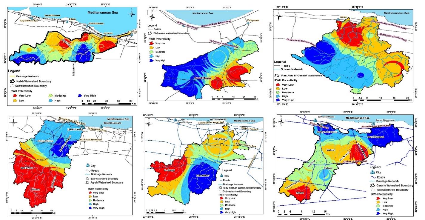
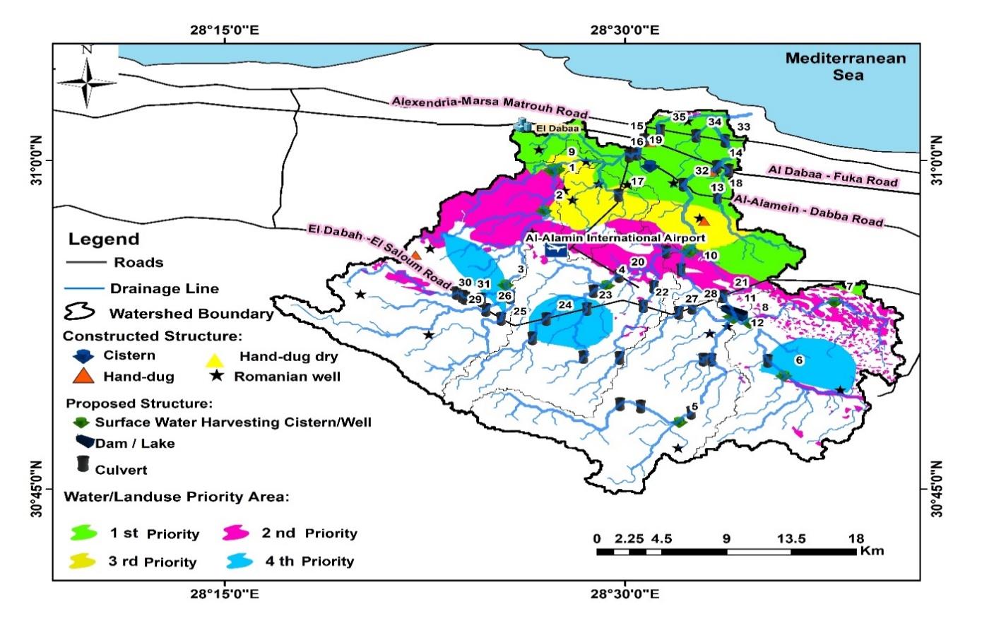
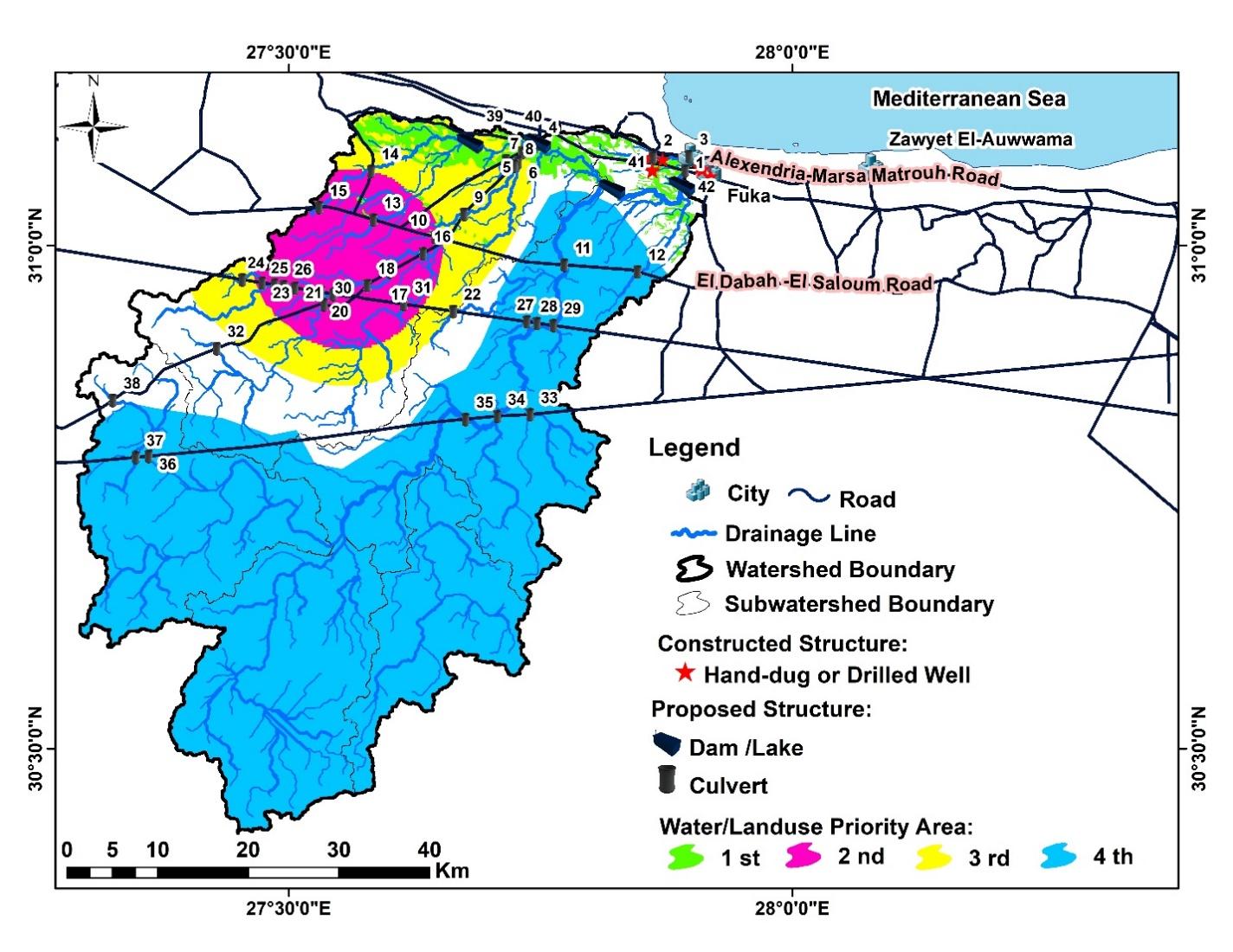
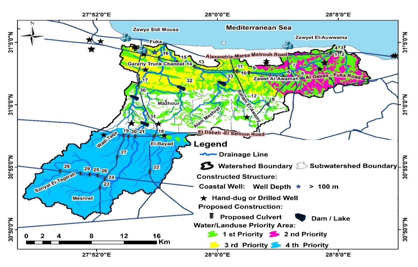
A collection of images that express the outputs
Latest Events
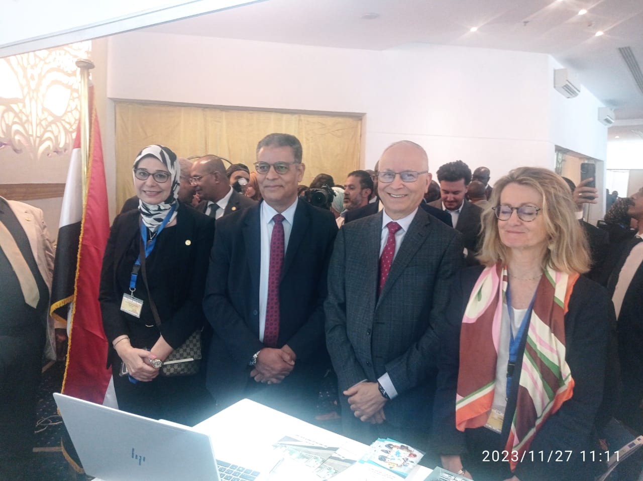
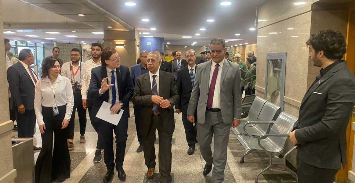
Latest News
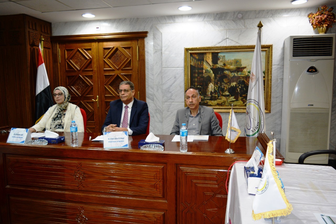
NARSS
National Authority for Remote Sensing & Space Sciences
NARSS is the pioneering Egyptian institution in the field of satellite remote sensing. NARSS is an outgrowth of a Remote Sensing Center, established in 1971 as an American-Egyptian joint project that was affiliated to the Egyptian Academy of Scientific Research and Technology


